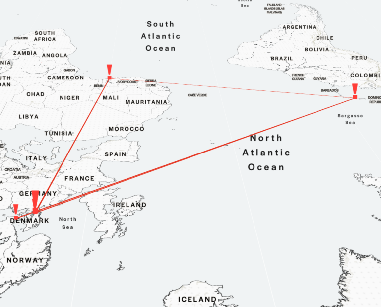
Colonial commodity sugar: Flensburg’s global entanglements
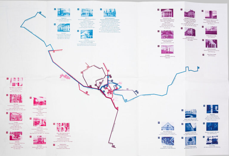
There is an article about Flensburg's colonial entanglements on the interactive map "Decolonial [Hi]stories" in the project Decolonial Memory Culture in the City.
There is an article about Flensburg's colonial entanglements on the interactive map "Decolonial [Hi]stories" in the project Decolonial Memory Culture in the City.
In an article published in 2024 in the journal sub\urban (German only), Sybille Bauriedl (European University Flensburg) and Linda Pasch (University of Bonn) look at postcolonial maps. The article examines the extent to which the maps combine decolonial politics of memory with a critical reflection on map production and the power of maps.

The illustration of the Flensburg shorelines shown on the homepage of the Flensburg Postcolonial Network is a collaboration between Felisha Maria Carenage and Nelo A. Schmalen. In a text we explain in particular the background to the graphic of the shorelines, which has its origins in a comparative map analysis by Nelo A. Schmalen.
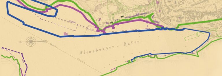
Nelo A. Schmalen's work deals with the urban spatial changes in the Eastern Harbour and explores the extent to which this space is characterised by colonial entanglements. The maps of the harbour area created as part of the work visualize changes to the harbour edge, the terrain and the infrastructure.

The project Sønderjylland-Schleswig Colonial aims to collect and communicate the colonial references in the region between Eider and Königsau. On the site there is, among other things, a map with colonial memorials in the region.